
What is LiDAR?
LiDAR (Light Detection and Ranging) is a mapping technology that uses laser pulses fired from an aircraft to measure the shape of the ground with incredible accuracy.
Unlike standard aerial or satellite imagery, LiDAR can often "see" through gaps in vegetation to reveal the terrain underneath. Millions of laser measurements are combined to create a detailed elevation model of the landscape.
Why is LiDAR useful?
LiDAR can reveal terrain features that are difficult or impossible to spot on standard maps, including:
Old tracks and roads
River terraces
Gullies and ridgelines
Landslips
Earthworks and historic features
Subtle changes in elevation
For trampers, runners and outdoor explorers, it can provide a much better understanding of the terrain, especially in steep or heavily forested areas.
Using the LiDAR overlay
💡 This feature is available for VIP members.
The LiDAR overlay can be turned on from the Overlays menu on New Zealand maps.
It sits on top of the normal map, allowing you to switch between standard mapping and detailed terrain imagery to better understand the landscape.
You can also adjust the overlay transparency so you can see both the map and the LiDAR data at the same time.
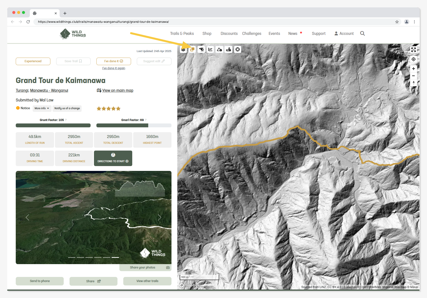
Coverage
LiDAR coverage is currently available for many parts of New Zealand, but not everywhere. The overlay will only appear where LiDAR data exists.
A few things to keep in mind
LiDAR is an elevation model, not a trail map.
It won't show whether a route is maintained, passable or safe, and many visible features are not official tracks.
LiDAR surveys are also captured at a specific point in time. Depending on when an area was surveyed, recent changes such as landslips, floods, forestry operations, new tracks or other landscape changes may not be reflected.
Always use your judgement, carry appropriate navigation tools, and plan your trip carefully.